Day four started out with surgery. Well, that’s what I called it. It was really attending to my blisters. I mentioned that at the close of day three I was too tired to treat my blisters. Well, around 1:00 AM I woke up, and the pain in my feet was unbearable enough that I needed to treat them.
The blister on my left foot had ruptured two days prior, and the skin was peeling off of it. I read in my first-aid guide what to do. It said cut away the dead skin with scissors, clean the wound with antiseptic, apply anti-bacterial, and dress the wound with gauze. I didn’t have scissors. I had a pocket knife and some tweezers, and that proved to make the situation all the more difficult. It isn’t easy to treat an open blister wound with those tools, but I managed. I was also not pleased to see that my first-aid kit only included two small packets of anti-bacterial ointment. I knew that I’d have to use it conservatively.
The second blister, not yet punctured, proved to be much more difficult to treat. The first-aid manual said to puncture it with a needle and massage it to drain it. Once again, I didn’t have the required tool, a needle. I figured my pocket knife would do. Let me tell you, though, my feet were already very calloused, and puncturing that blister with a pocket knife was not very easy. This may be disturbing to some readers, but I literally had to saw through the calloused skin in order to puncture the blister. The whole process took a good ten or twenty minutes. Once done, though, I got the puss out, cleaned the wound, and applied a bandage.
I had a little anti-bacterial ointment left over from that first packet, and I used it on my lips, which had become quite chapped. I’d failed to bring any sort of lip balm, even though I’d been told to bring some. The ointment worked, but I knew I couldn’t rely on it for my lips, because I only had one small packet left and I’d need that for further treatment of blisters. Having treated the wounds I was able to sleep through the rest of the night.
When morning came I had a quick breakfast. The usual Pop Tarts, cereal bars, and jerky. I even tried making some powdered milk, which wasn’t very tasty. Also, the painkiller I’d taken the day before had been so effective at helping me along, that I took another pill. And I’d take a pill every morning for the rest of my journey. I like to joke about how I was living off of painkillers and energy bars.
My task for the day was simple. First I needed to make it to Red Knob Pass, then onto Dead Horse Pass. I planned on staying at a place called Ledge Lake. I was worried though. I’d looked in my guide book, and it said that snow could be blocking the way as late as July, so I wasn’t sure I’d actually be able to make it over the passes. I figured if I couldn’t I’d have to veer south. I was also worried because my map indicated that Dead Horse Pass was “hazardous to horses and pack stock”. In my mind, Porcupine Pass, from the day before, was about as hazardous as I could imagine, and I was expecting even worse from Dead Horse Pass.
I set out. My first major marker was to be Lambert Lake. I had hoped to make it that far the day before, but hadn’t been able to. I figured once I got near Lambert Lake, I’d check my progress.
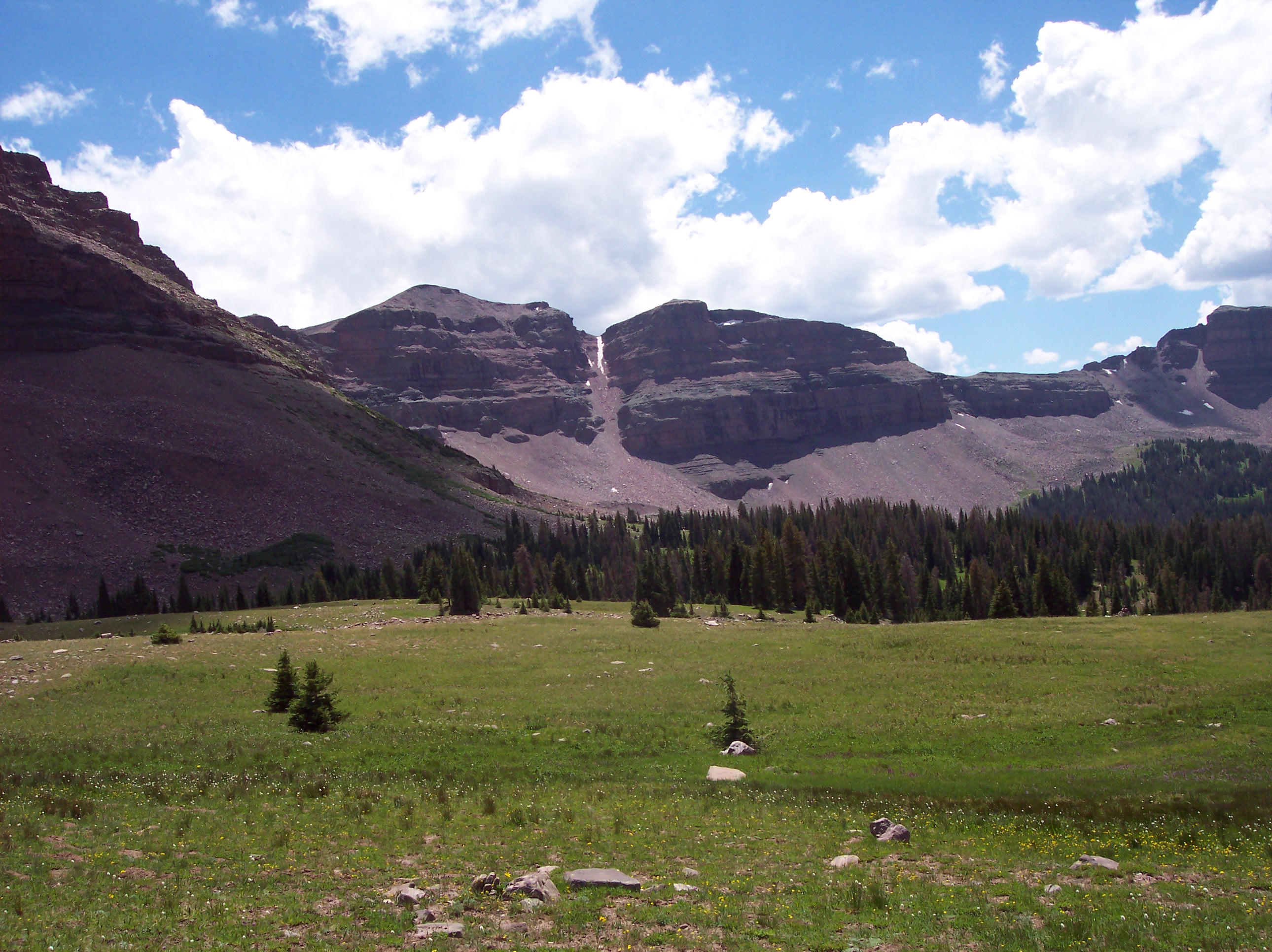
The morning’s travels were difficult. It was a combination of thick forest, and rocky areas above the treeline. I lost the trail, briefly, after it crossed over a stream. At that point, it felt natural to head south, back below the treeline, but my map indicated that the trail followed the base of the nearby peaks, so I searched for the trail in the rocky areas. Eventually I found some rock cairns that were, indeed, near the base of the mountain and I continued my journey. From there the trail wasn’t too bad, and I couldn’t help but think that if I had wandered south, I’d have been lost for quite some time.
After what seemed like hours, I finally came across a small pond. I checked my map to see where that pond might be. I’m pretty sure it was a little to the north of Lambert Lake, so I had a pretty good idea of where I was. I continued following the trail, and eventually I got to a sign that said, “Lambert Meadow”. This made me wonder if I hadn’t made it as far as I thought I had, when I found that pond. However, my map indicated that Lambert Meadow was to the west of Lambert Lake, and I was making progress after all.
A river runs through Lambert Meadow, and the trail crosses over it. When I got there, it didn’t look good. If I was to cross right at the trail I’d get my feet wet, and I didn’t want the dressing on my blisters to come apart, so I wandered a ways upstream, hoping to find a better crossing. I sort of did, I found a part of the stream with more boulders in it, and I made my crossing there. This was almost a fateful moment, because my backpack got snagged on a tree branch as I crossed, almost tipping me into the water, almost. By luck I made it safely across, and I thought to myself, never again, I’ll just submerge my feet next time.
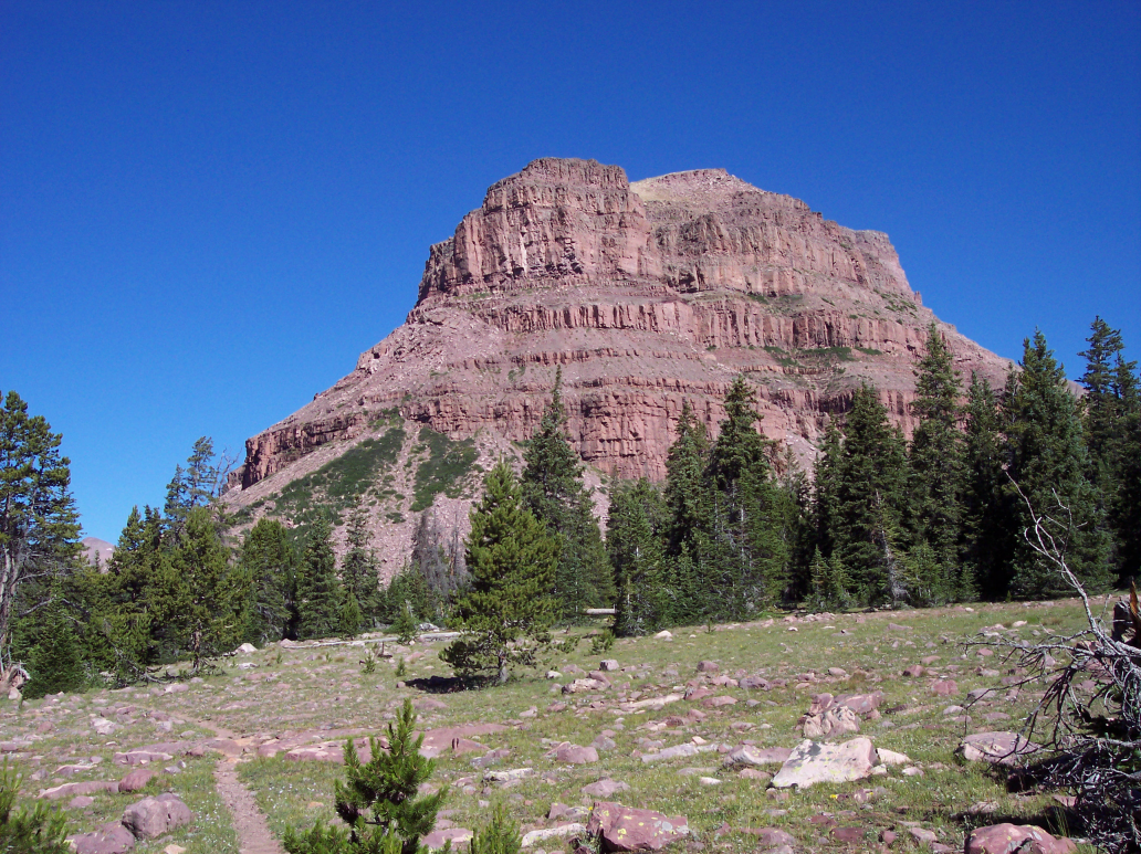
For the most part, progress through Lambert Meadow was fast. It ends with some switchbacks that lead back down into the forest. I couldn’t say I was excited about the decline in elevation. Red Knob pass was my next major marker, and I wanted as little uphill as possible. I was actually feeling pretty miserable that morning. I thought that maybe I’d only cross Red Knob Pass, and leave Dead Horse Pass for the next day. Maybe I felt so miserable because my water was dirty. I pressed on. The trail veers sharply to the north as it approaches Red Knob Pass, and it’s a steady incline all the way there. It’s maybe five or six miles uphill. Eventually I got out of the treeline, this was deep in the Lake Fork Drainage and I could hear the Lake Fork River running violently to my left. Above the treeline there was also a lot of grazing sheep, and as I would approach a group of them, they’d run away.
After getting past the grazing sheep, the trail was much more vague. I suppose because horsemen don’t go up any further than the grazing grounds. I found myself losing the trail more and more, so I figured it was a good time to stop for lunch. I had run out of water at that time as well, and needed to purify more. There was spring water there, and it was much cleaner than what I had gathered the previous day. I was excited to have clean water.
My lunch was not the usual either. Yes, indeed, I had something different. I had tuna fish packets, and I ate one. I put some spices on it too, made it taste really good. I did have the usual Clif and cereal bars as well, but the additional tuna made the meal a little more interesting. Once I had enough water purified, I continued on. As I said, I’d lost the trail. All I really knew, was to head in a generally north direction. I did so. Leading up to Red Knob Pass, the trail was off and on, but it would be pretty hard to get lost anyway, since you can pretty much see all the major landmarks.
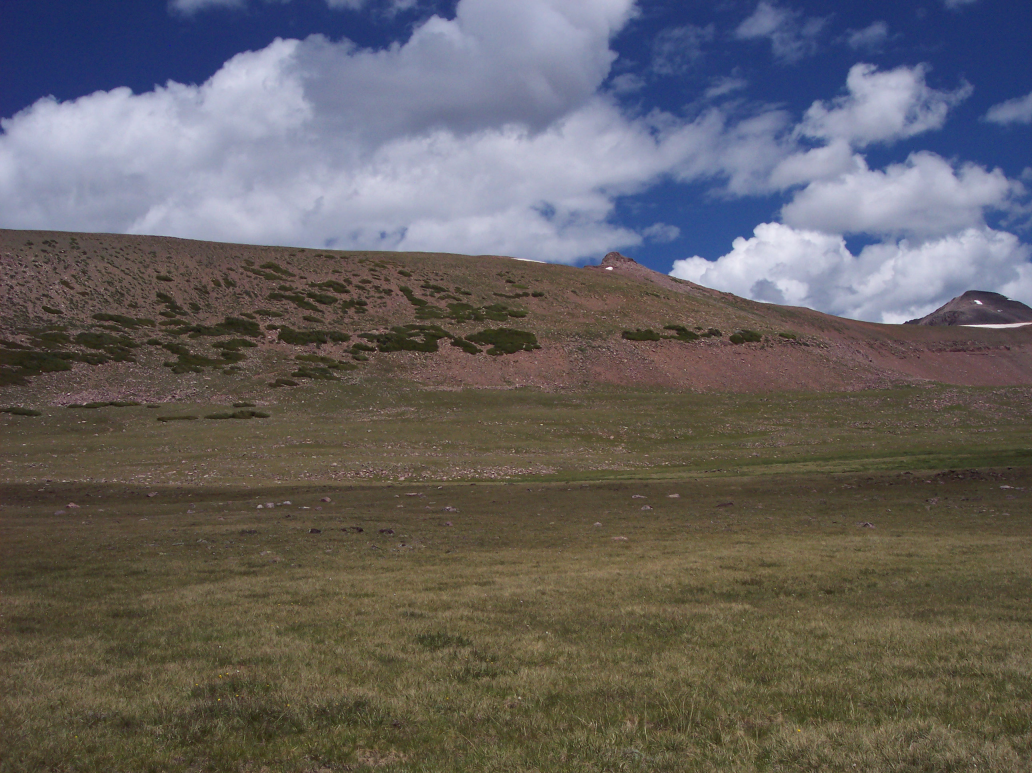
As I approached the base of Red Knob Pass, I didn’t know if I wanted to go on. It didn’t really look that steep, but I was tired. I was thinking that maybe I should have taken that day of rest, that I’d thought about taking the day before. I was already there, however, so I continued. Red Knob Pass was the second most difficult pass for me to go over, almost as difficult as North Pole Pass. Technically it shouldn’t have been so difficult, but there was something about it that made it extra hard.
I found myself counting steps as I went up it. I’d try to get to at least twenty five steps before stopping for a few seconds to catch my breath. I think part of what made it so hard was the high altitude, my breathing was heavy, but I pressed on. I made it to the top, and I was somewhat pleased with myself. The trail branches there. One trail goes to East Fork – Black Fork (where I thought the two guys I’d met the day before were going), and the other trail lead to my next destination, Dead Horse Pass. I didn’t stop for very long atop Red Knob Pass, and I didn’t need to.
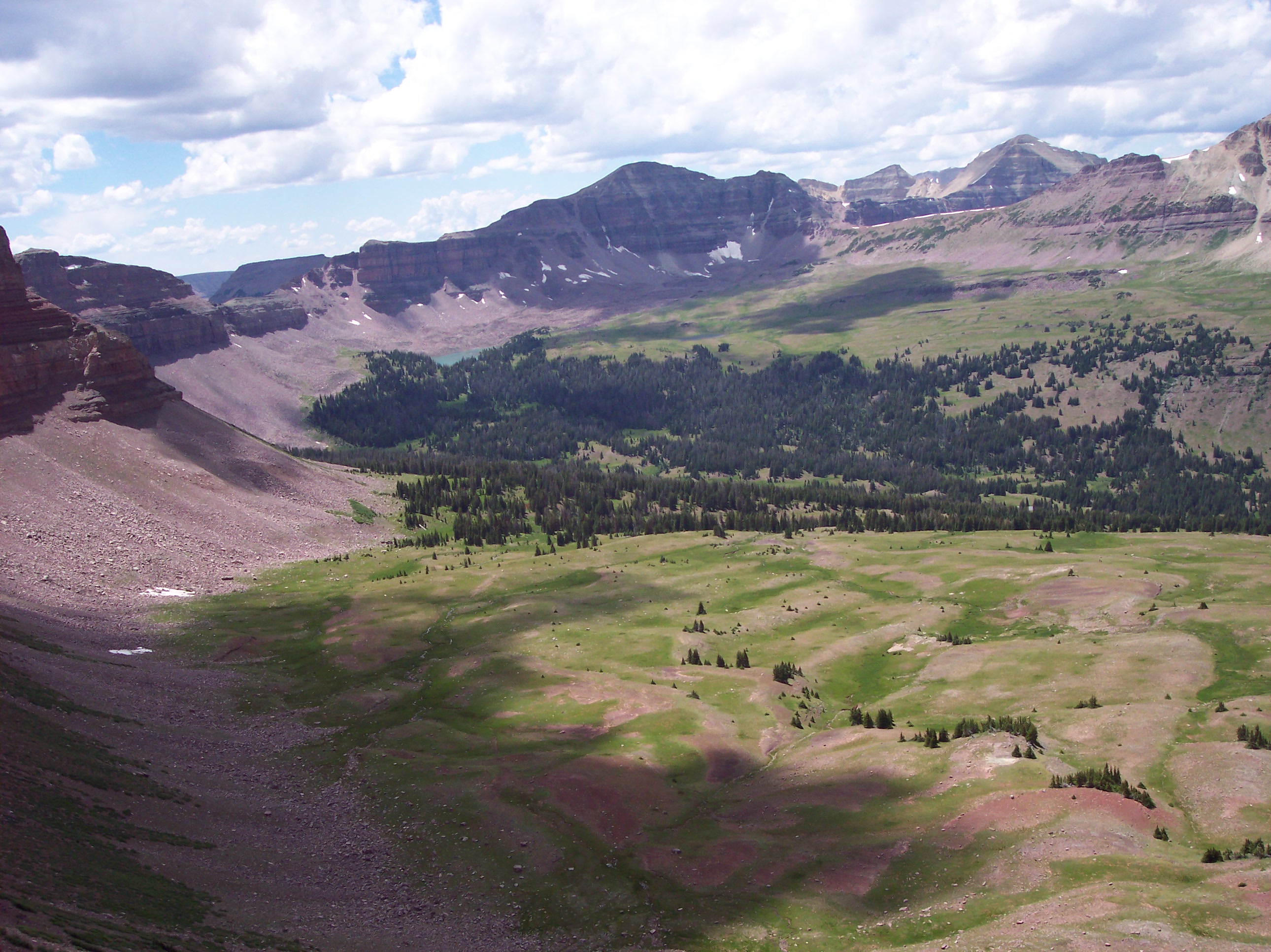
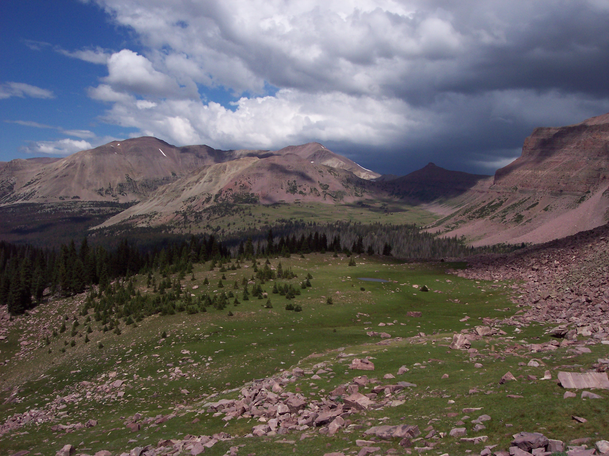
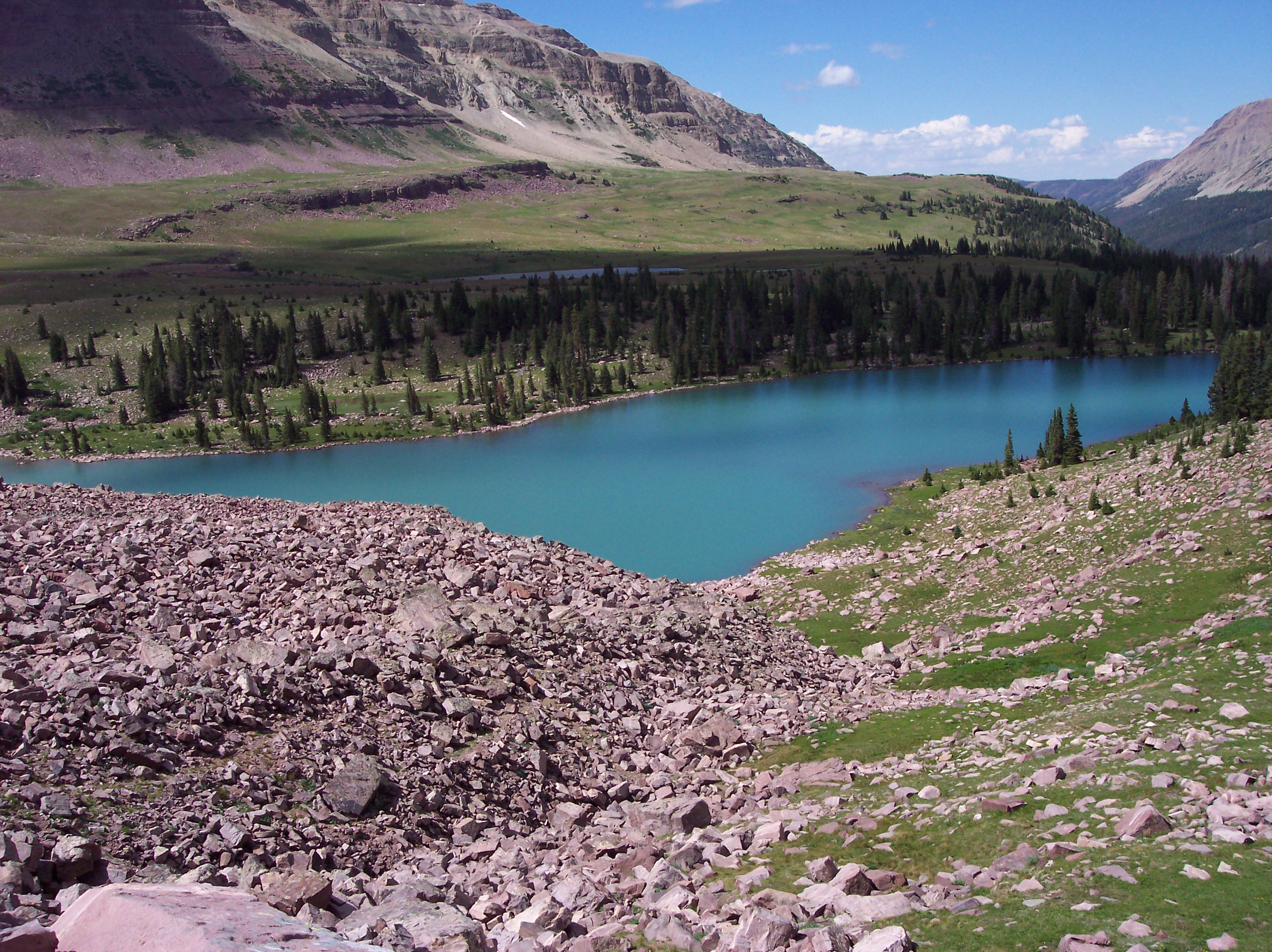
Going down was so much easier. I was literally zipping along. When I made it down a little ways, the valley below came into view and I saw one of the most beautiful sights I’d ever seen. The picture I’m providing will only begin to give you a glimpse of what I saw. I was amazed. Somehow, in that moment, all my pain and suffering was worth it. I couldn’t help but think that there were few people that would ever see what I was seeing right then. I could see Dead Horse Lake, which lays below Dead Horse Pass, and it didn’t look that far.
I continued making my way down. To my satisfaction, I bumped into some people going up. A youth group. The first adult I met in the party stopped to chat for a moment, he seemed pretty miserable. He said they were headed to Lambert Meadow, I told him he was in luck, once they got to the top of Red Knob Pass, it would be almost all down hill from there. We departed.
At the base of the pass, I met a man who I think was the guide of the youth group. We chatted for quite a bit longer. I told him where I’d come from, and he was quite impressed. He said he had tried to make the same journey some years ago, but he’d gone too early in the year and there had been too much snow on Anderson Pass, and he had to turn back.
He talked about where the youth group had come from, where they were going. They’d started on Saturday, like me, and had been out for four days as well. They hadn’t made as much progress, but then, they weren’t trying to go as fast as me. He told me how is wife and son were with him, and how he was carrying most of their gear, and that they were down to twenty pounds apiece, while he was at fifty. I couldn’t help but comment on how easy it would be if I was only carrying twenty pounds. I could have run the whole way.
It was nice having a somewhat lengthy conversation with someone. He asked where I was spending the night. I said if I was too tired to go on, I’d stay at Dead Horse Lake. He said they had stayed at Ledge Lake the night before, and I told him I’d been hoping to make it that far.
We said our farewells, and I was off. It was so easy, traveling through that valley, and my body was feeling really good. The trail was very well defined, and progress was fast. I saw Dead Horse Lake right next to me, and it wasn’t even 4:00 PM. I’d decided that morning that if I was at Dead Horse Pass before 4:00 PM I’d go over it, and that was the case, so I began to make my ascent.
Dead Horse Pass was surprisingly easy to go up. I think it’s steeper than Red Knob Pass, but it sure didn’t feel like it. Maybe it’s because I had more energy at that time of day. I don’t know, but I was speeding on up.
A little ways up the pass I bumped into another lone backpacker that was coming down. We had a brief conversation about being in the wilderness alone. He told me that on that very pass, on a previous trip, he had lost the trail and ended up on a game trail. He made it so far down on the game trail that he couldn’t climb back up. He said he thought he was in some real trouble then, but made it down safely. This conversation would prove useful to me later on. To end the conversation he asked if I was good on supplies, I said that I was, but afterward I wondered if I should have asked him the same, because maybe he needed something.
As I said, it was easy going up, and I reached the top, but then I couldn’t find the trail. Indeed, right on the top of the pass I had no idea where the trail was. I saw a what looked like a trail to my right, and I followed it a ways, making progress slowly, then I realized that I must have been on a game trail, just like the lone backpacker I’d encountered had been on. I may have been able to climb my way down from there, but I thought that I should try to make my way back to the top of the pass and find the real trail. I did so, and at the top of the pass, wandering around a bit, revealed the true trail.
About that time the sky was growing gray. It looked like rain, and not just rain, a thunderstorm. I moved fast as I made my way down Dead Horse Pass, and to my satisfaction, this pass felt much more safe than Porcupine Pass. I was down quick. I wanted to get to the treeline before it started raining, so I moved as quickly as I could. It took maybe half an hour to get to the treeline, and and right after I did, the rain started picking up. I got my rain gear out and equipped it. I was getting close to Ledge Lake, where I intended to stay. So I kept an eye out for it. There was a trail junction right next to the lake, and I figured that would be my next milestone, and when I found it, I’d search for the lake.
I didn’t have to search for the lake, I could see it before I ever got to the junction, and when I did, I started wandering around it, looking for a decent camping spot. I don’t think I found a super great camping spot, but it was close enough to the lake that I wouldn’t have to look around for water. I was so tired that it was a struggle to set up camp. I had originally intended to have one of my freeze dried dinners that night (I had two), but I was too tired to make it. Once again, I didn’t purify water. Dinner was trail-mix, jerky, and Clif Bars. The ground was hard beneath me, but I made the best of the situation, and tried to sleep. It would prove to be the worst night of my vacation, as you’ll see on Day 5.